
Relatives
Distribution area of sandy bluegrass (Poa sabulosa) .
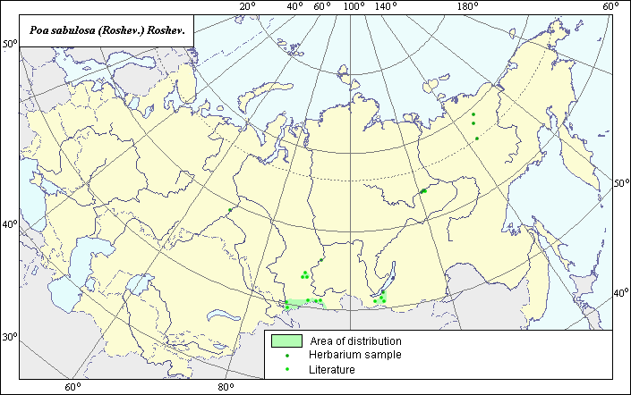 Object description Download GIS-layers
Authors:
Object expert and GIS-expert L.L. MalyshevDate of creation:
29.03.2005Scale:
1:20,000,000.Accuracy of map:
Map was created using maps of scale 1:2,000,000-1:11,250,000.Projection:
"Alber.s Equal Area Conic for the USSR", 9, 1001, 7, 100, 0, 44, 68, 0, 0.Basic contents:
Vector map consisting of 1 base layer and 3 thematic layers. The species distribution area is shown by a polygon and points.Accuracy of qualifier:
Points represent locations from which L.E. herbarium samples were taken and species locations referenced in published literature. The polygon was created using general species distribution data from published sources.Mapping procedure:
The map was created using species locations provided by the L.E. herbarium and published maps from Malyshev & Peshkova (1990). The species sporadically occurs in steppe areas of the Altai Mountains, the Sayan Mountains, Transbaikalia, Yakutia and in river valleys of Yenisei and Yana.Source of data:
Malyshev L.I., Peshkova G.A., eds. 1990. Flora of Siberia. Vol. 2. Poaceae (Gramineae). Novosibirsk: Nauka, 361 pages.Rights and copyrights:
All rights to the map and its description belong to its author.Copyright on the photos belongs to E. Dzyubenko.